The Sign Goes Up Last: How to Search a Parcel's Paper Trail Before Your Block Changes
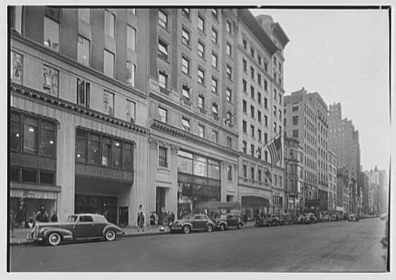
Photo: Gottscho-Schleisner Collection, Public domain, via Wikimedia Commons
Neighborhood change has a bad habit of arriving as a surprise. A fence goes up, a surveyor wanders through, and suddenly everyone on the block has a theory. The theories are usually wrong, because the actual answer has been sitting in a county database for months.
Zoning records aren't glamorous, and nobody hands you a decoder ring at closing. But a municipal GIS portal behaves a lot like a search engine if you know what to type into it. You search a parcel, you pull a thread, and the thread usually leads to a planning commission agenda with your street name on it. This is a routine for renters, buyers, and small-business owners who'd rather read the paperwork than the rumor.
Start With the Parcel, Not the Address
An address is for mail. A parcel number is for records. Your county assessor or city GIS portal — many run on ArcGIS, some on custom map viewers — lets you type in a street address and click the lot. Once you're in, grab three things: the parcel or account number, the current zoning designation, and any overlay districts attached to it. Overlays are the fine print that can ban short-term rentals, cap building heights, or add design review to anything visible from the street.
Write those three items down before you get distracted by the aerial imagery. The parcel number is your master key. It works in permit systems, agenda archives, and property search tools even when the address format changes, which it will.
Decode the Code (It's Searchable)
Municipal codes are published online by outfits like Municode, American Legal Publishing, and eCode360, and they're plain text. That means you can open your city's zoning chapter and use your browser's find function like a search bar. Search the zoning code letters you pulled — say, R-2 or C-1 — and read the use table. What's permitted by right? What needs a conditional use permit? What's the maximum height and lot coverage?
This is where a lot of rumors die. That empty lot everyone says is going to be a gas station may be zoned for single-family homes with a 35-foot height cap. Or the opposite: the modest house behind you sits in a corridor that allows four-story mixed use with no public hearing. Either way, you now know which conversation to have, and with whom.
The Permit Portal Is a Timeline
Most US cities run permitting through Accela, OpenGov, Citizen Serve, or something similar, and most of them expose a public search. Search the parcel number and look at the activity log. You're not just hunting for big projects — you're looking for small tells. A demolition permit. A lot-line adjustment. A grading permit with no building permit behind it. A series of expired permits suggests a stalled project, not a dead one.
Sort by date and read backwards. Repeat filings for the same address often mean a developer is iterating, and the plans get clearer with each pass.
Agendas Are the Early Warning System
Planning commissions and zoning boards publish agendas and packets through Legistar, BoardDocs, CivicPlus, or plain PDFs on a city website. These are the single best source of what's coming, because a rezoning or variance has to appear there before it can happen. Search the agenda archive for your street name, the parcel number, and the names of adjacent large owners.
Packets are usually long, so use Ctrl+F and don't read cover to cover. Look for staff reports, which summarize the request in plain language, and for the future land use designation attached to the site. If a case is scheduled, attend or send a comment — the record is built before the vote, not after.
The Future Land Use Map Is the Tell
The current zoning map says what's allowed today. The comprehensive plan's future land use map says what the city intends. When those two disagree for a specific parcel, that's the highest-value signal you can find. A low-density lot labeled for future commercial or high-density residential is a candidate for rezoning, and rezoning applications leave a trail months before construction.
Find the future land use map in the planning department's documents, compare it to the zoning layer, and note the gap. That gap is your watch list.
Set a Trap and Let It Work
Searching once is a snapshot. Searching on a schedule is a system. Subscribe to planning commission agenda emails if your city offers them, and set a Google Alert for the parcel number in quotes and for the project address. Save your GIS search URL with the parcel selected so you can return in one click. Many permit portals also let you bookmark a record and receive status updates.
Ten minutes of setup buys you months of notice. That's the whole trick — not cleverness, just a saved search pointed at the right public record.
What the Listing Won't Tell You
Real estate listings describe a property as it exists. They rarely mention that the vacant field next door has a pending rezoning, or that the warehouse across the street was granted a height variance last spring. Those facts live in government records, and they're free to read. The catch is that GIS layers can lag behind approvals, and staff reports get updated at the last minute. When the stakes are high, call the planning department's front desk and ask a human to confirm what you found.
None of this requires a subscription, a title company, or a contact inside city hall. It requires a parcel number and the willingness to treat a government website like what it is: a search engine that happens to know your neighborhood's future.